Trail Report

Sunday April 28, 2019 9:03PM

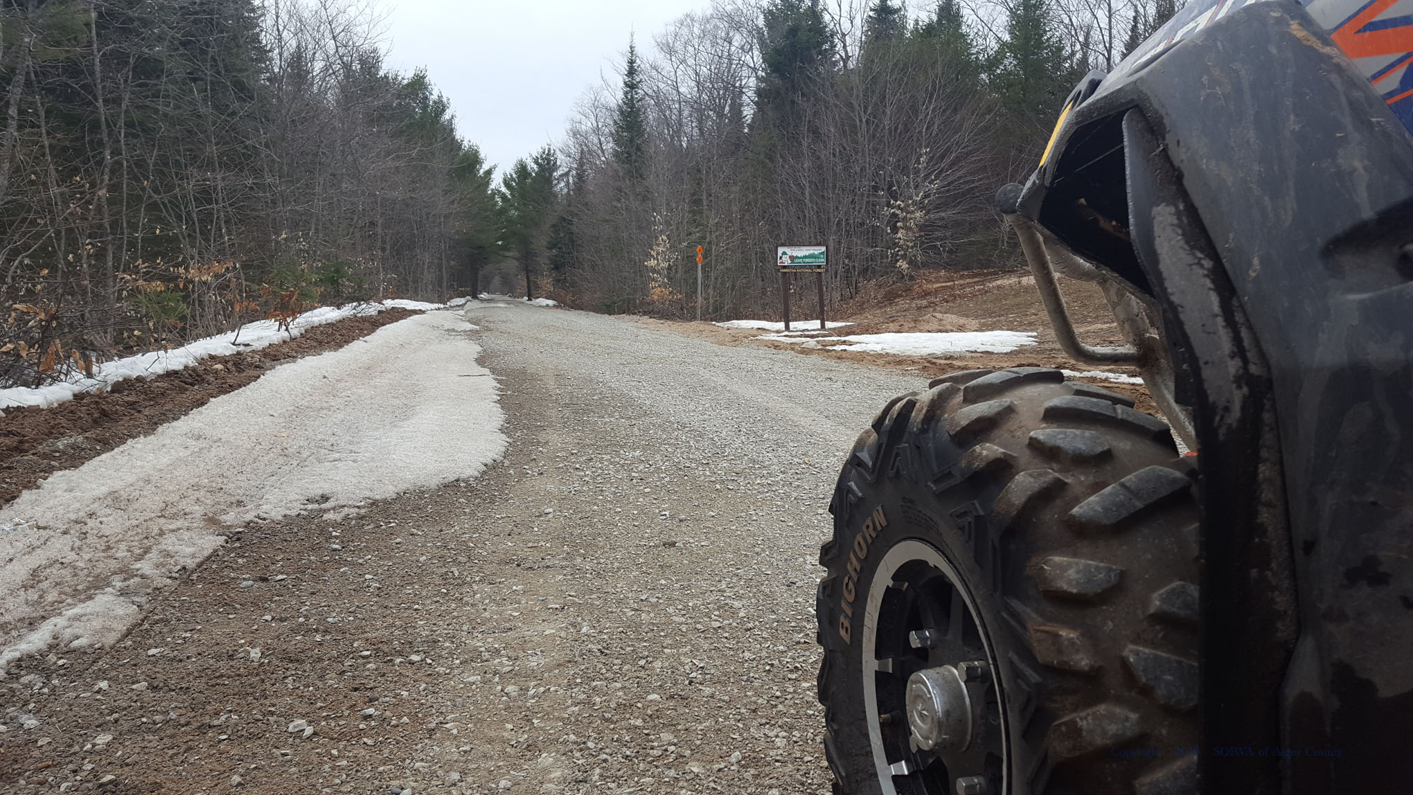
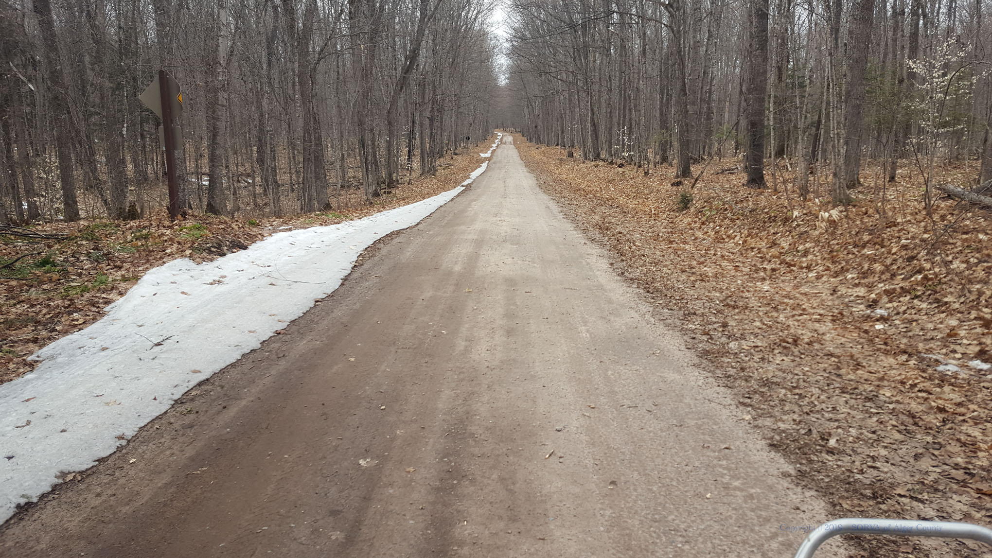
Good overall conditions

Ice Patches Surface

4 general warnings

4 trail warnings

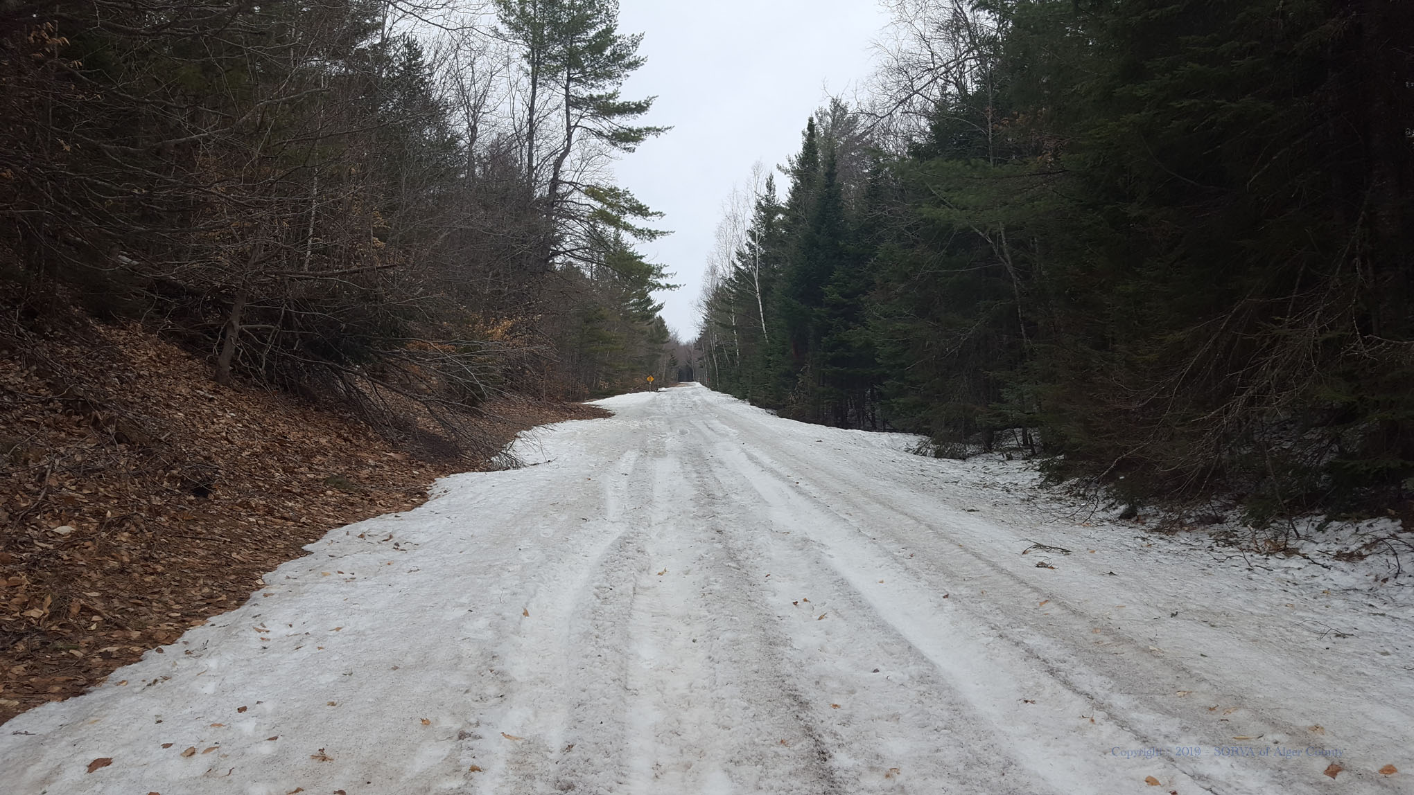
Trails are currently in a Good overall condition for ORV riding.
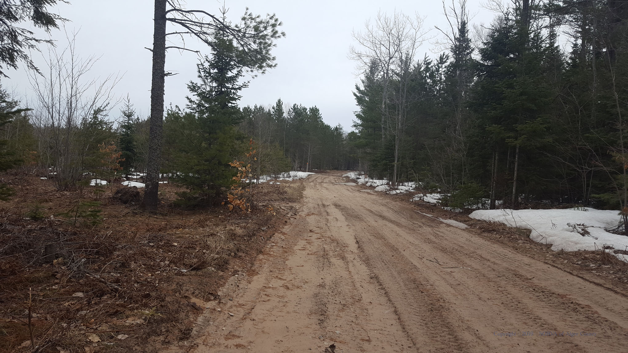
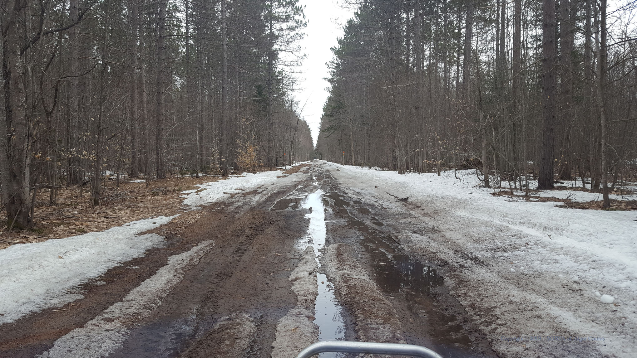
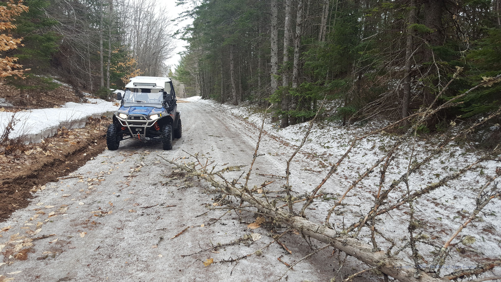
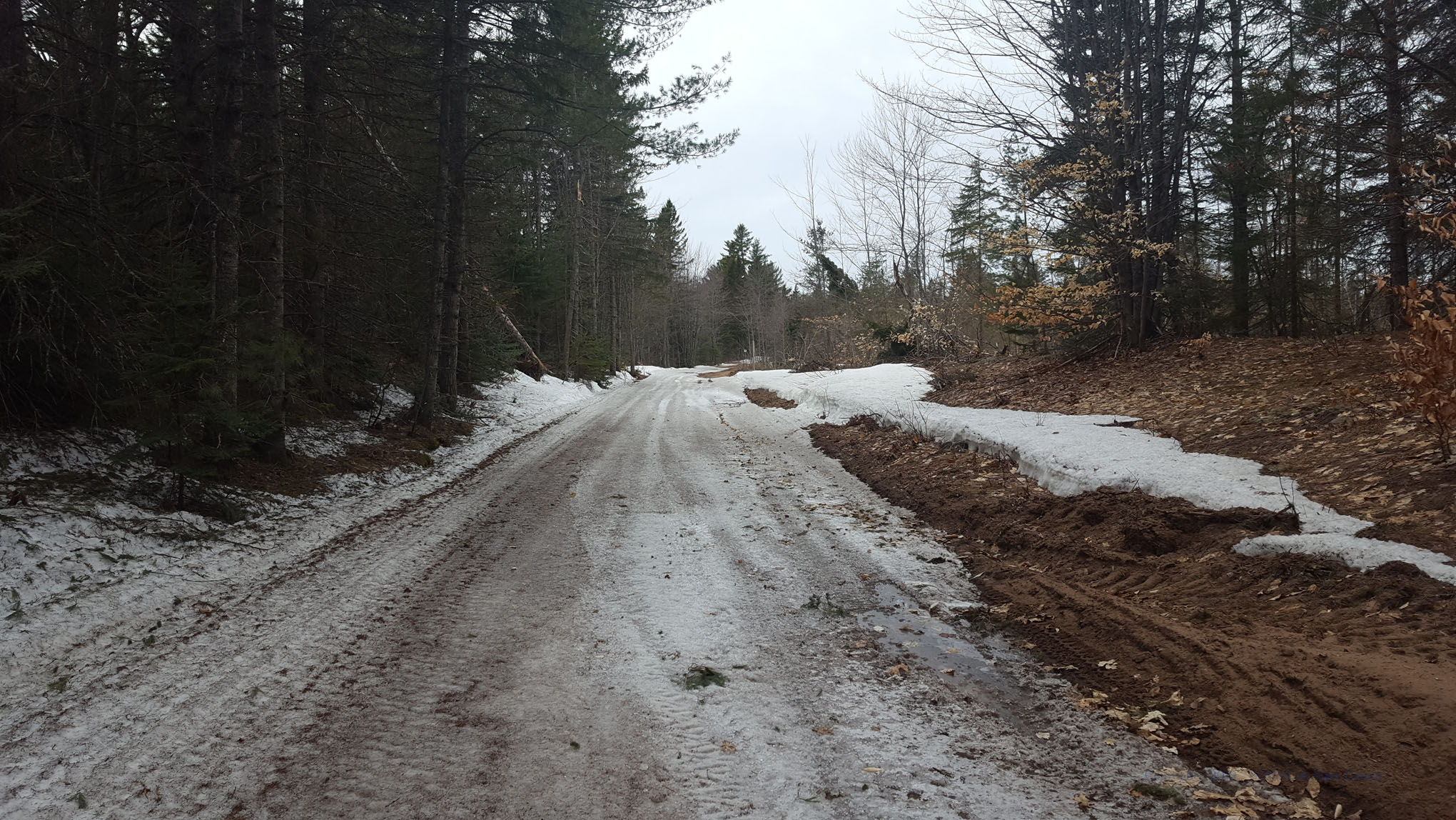
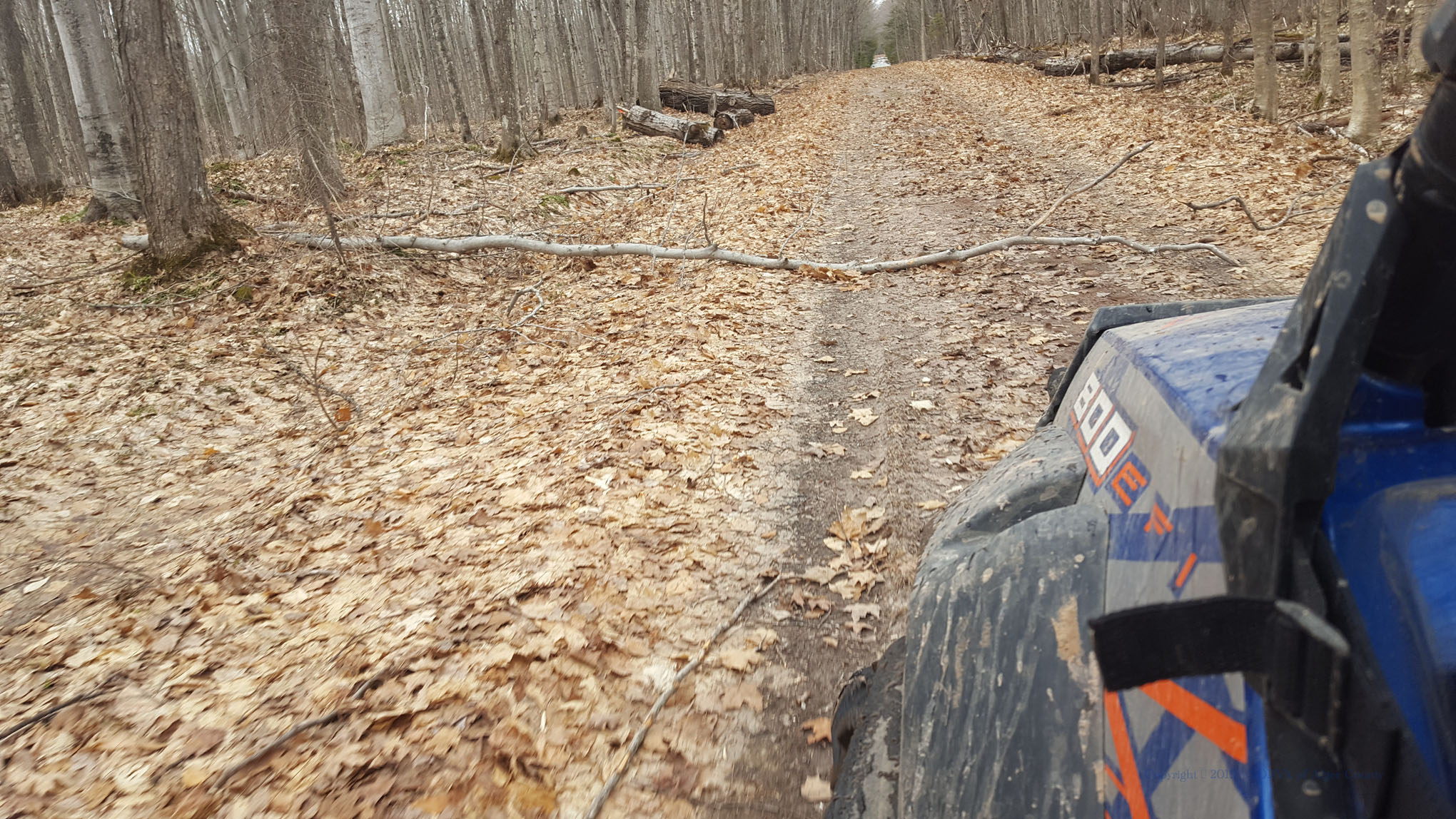
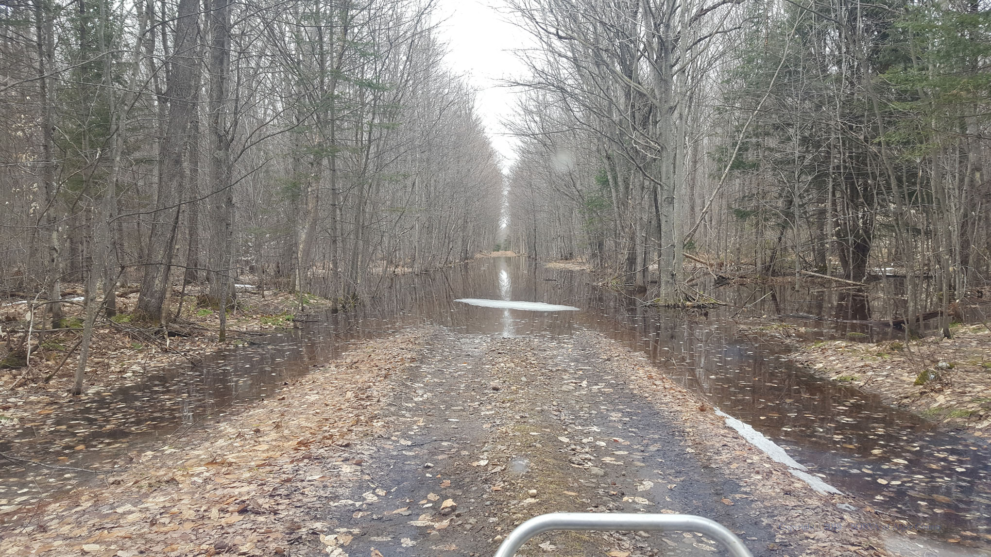
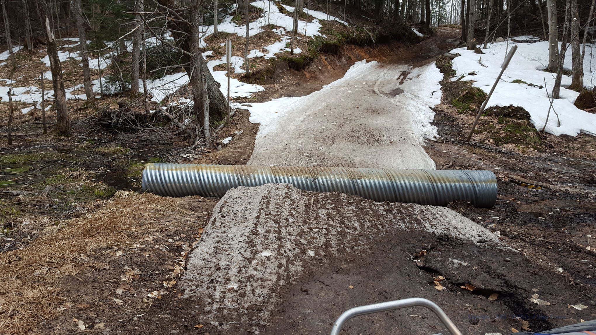
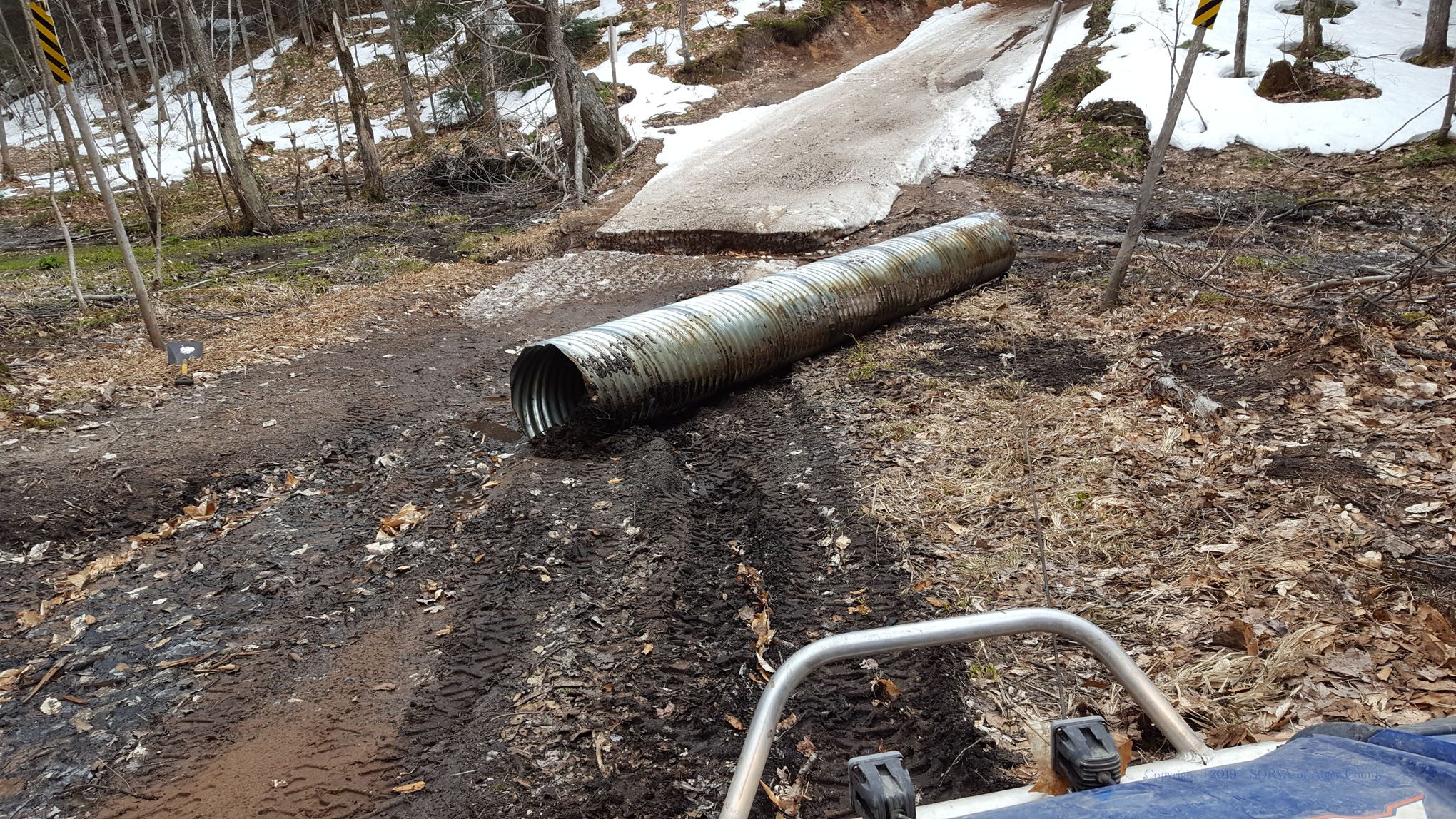
The trails are 60% covered with a packed snow base. Fun riding trail conditions, wet and icy in areas.  A quick melt has created some flooding and hazardous trail conditions. High winds also had multiple downed trees which have been cleared, many by other riders passing through which is greatly appreciated. We have also removed the culvert on Trail 419 between Munising and Wetmore so use extreme caution, there is a deep pocket in the snow to cross. Trail conditions change quickly this time of year so be safe by slowing down and expect obstacles around every corner.
Ride Smart, Ride Safe and Have Fun!

(Tip: photo URL lists location such as “www.algersorva.com……/042819_T8E-3.jpg” is Trail 8 East)

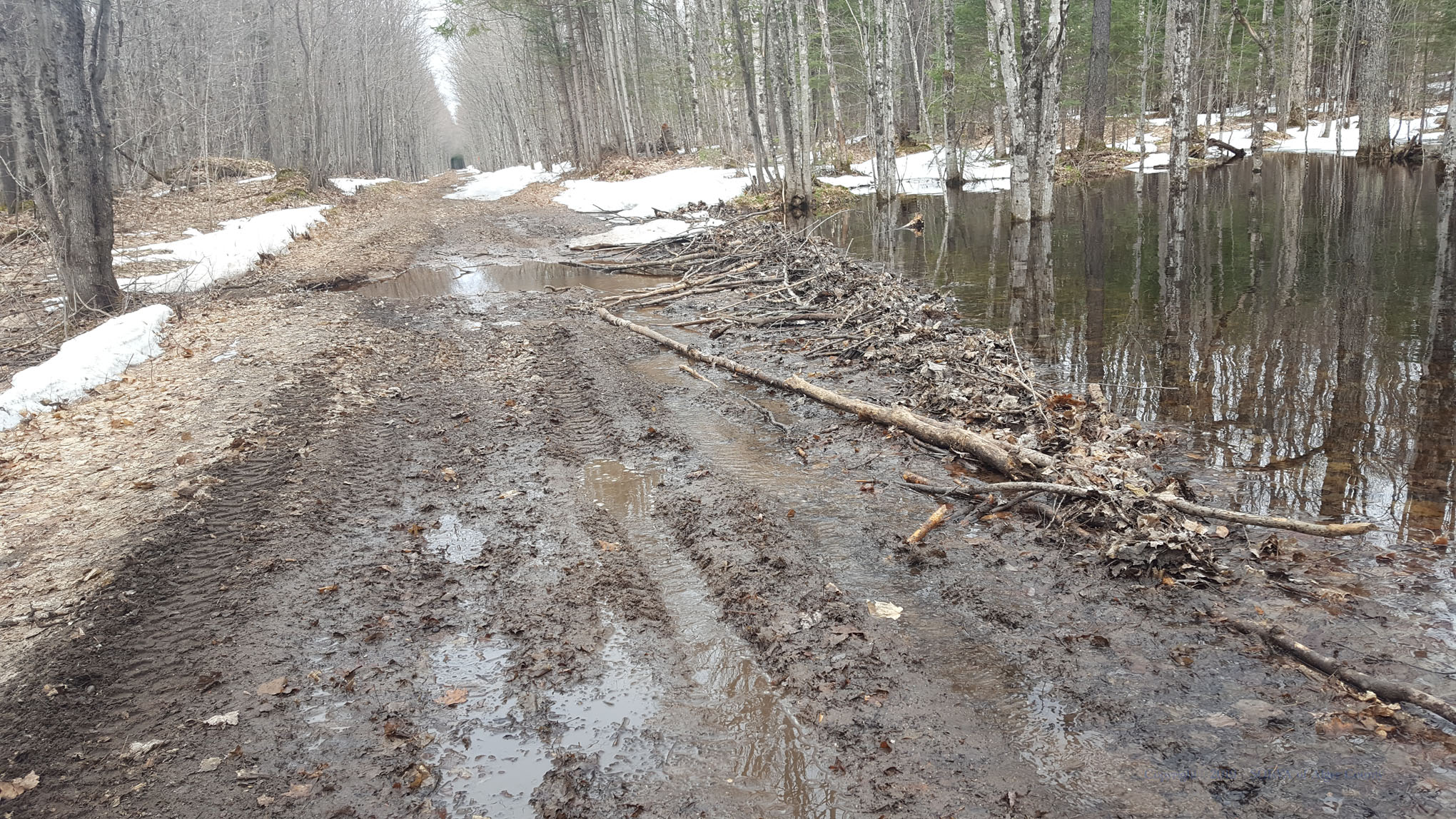
ICE, SLUSH, RUTS, WASHOUTS

- Ride with caution, areas of hard packed snow base remains with icy patches, ruts abd deep washouts crossing flooded hardpack snow in areas.
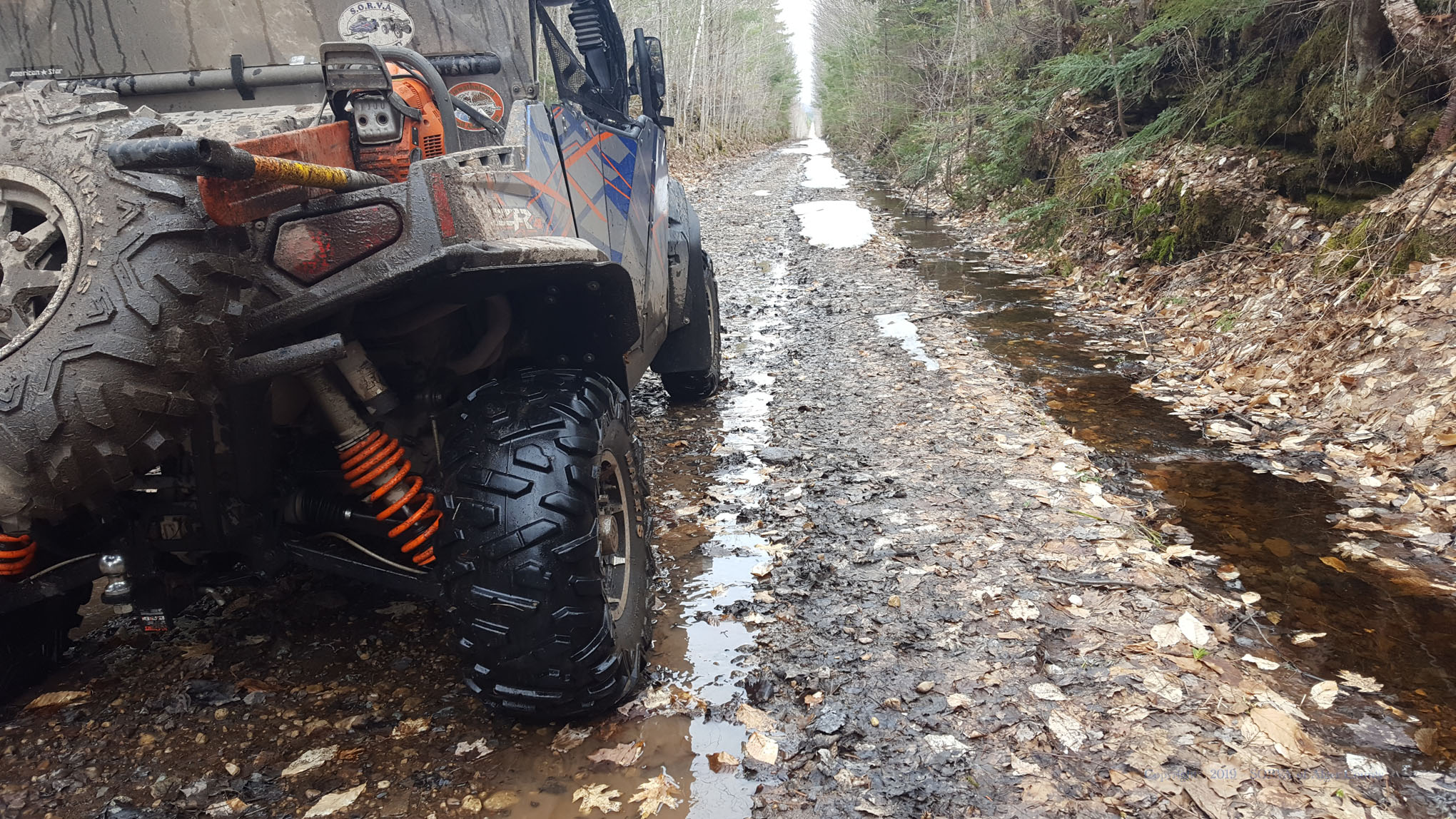
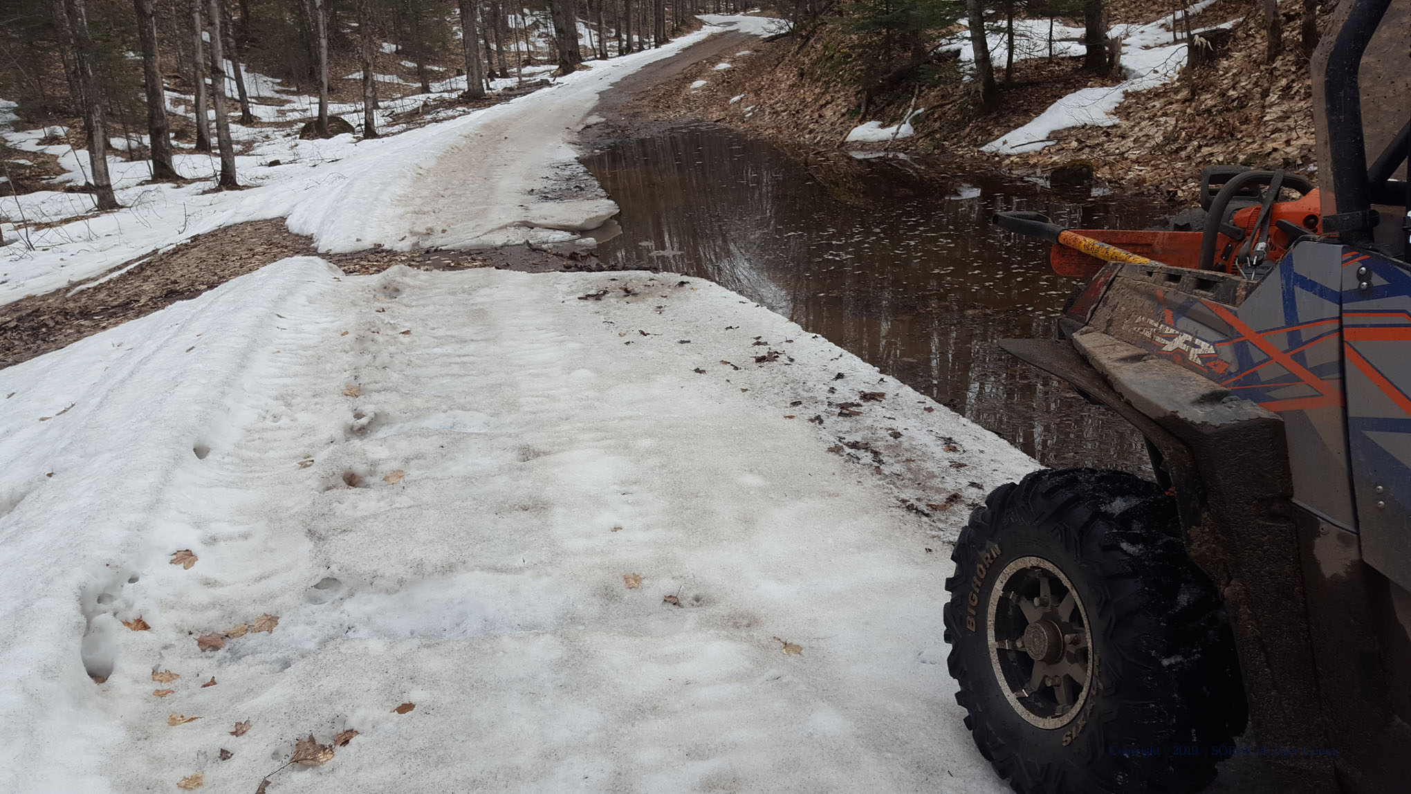
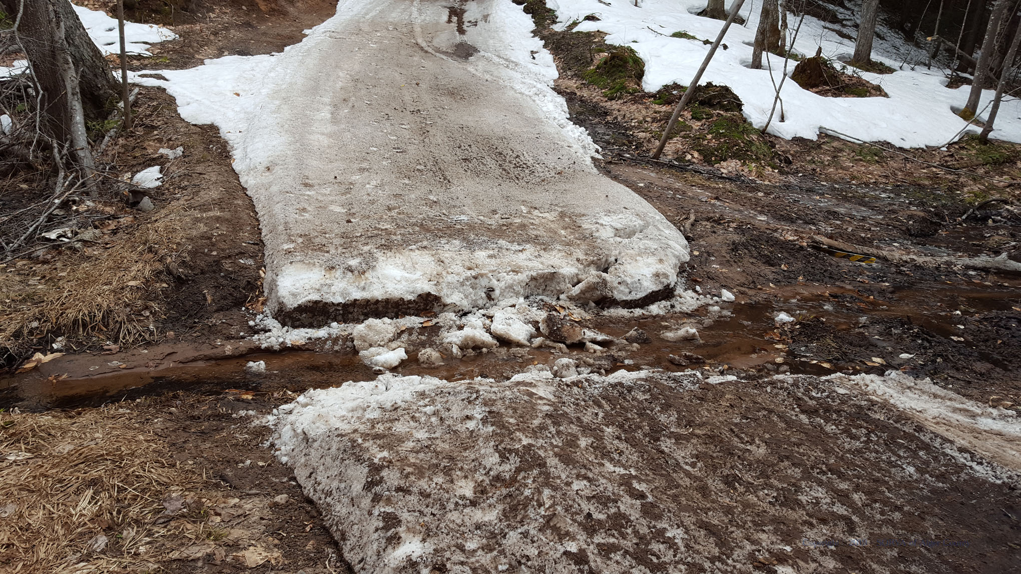
Trail 419 HAZARD

- Trail 419 between Munising and Wetmore has the temporary culvert removed. Ride with extreme caution as there is a deep cut in the snow to cross - see photos

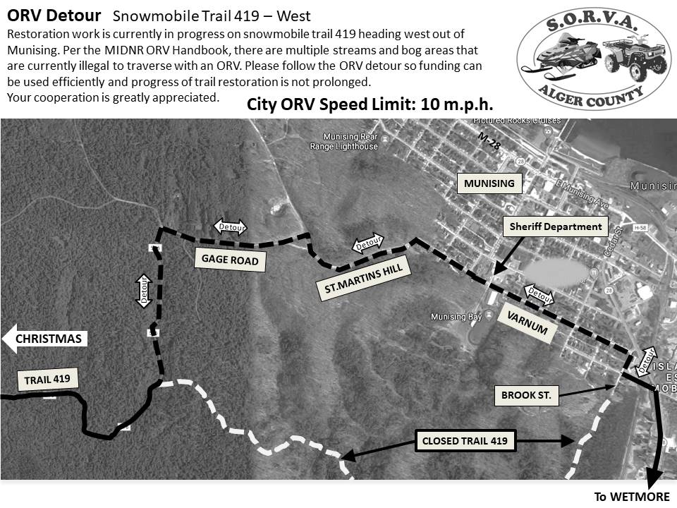
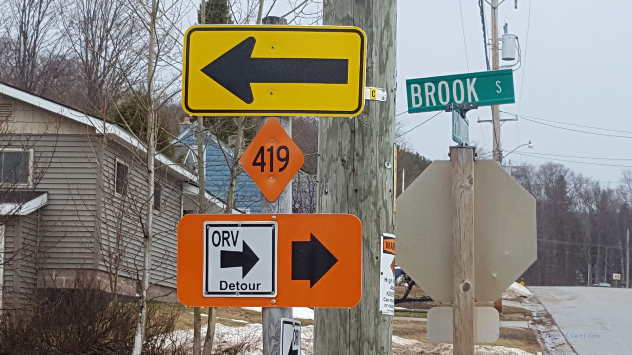
Trail 419 CLOSED Section

- Trail 419 is closed to wheeled vehicle traffic for two miles from Munising toward Christmas starting at Brook street. Follow ORV Detour - see route & sign photos

Trail 422 CLOSED in Pictured Rocks National Lakeshore

- Trail 422 is CLOSED to ORV's in the Pictured Rocks National Lakeshore. Miners Castle is NOT Accessible. You can only ride as far north as the Miners Castle Road / Carmody Road Intersection.

Trail Conditions

8 East - Shingleton

Ice Patches

(Marquette-Manistique ORV Route) - 60% hard packed snow cover, wet with soft spots and ruts.

8 West - Chatham

Ice Patches

(Marquette-Manistique ORV Route) - 60% hard packed snow cover, wet with soft spots and ruts.

Washout crossing hard pack snow on flooded corner a few miles west of Trail 7 North (Marquette-Manistique ORV Route) intersection.

7 South - CR440

Ice Patches

40% hard packed snow cover, wet with soft spots and ruts.

7 North - Christmas

Ice Patches

(Marquette-Manistique ORV Route) - 60% hard packed snow cover, wet with soft spots and ruts.

419 East - Wetmore

Ice Patches

80% hard packed snow cover, wet with soft spots and ruts.

419 West - Munising

Ice Patches

60% hard packed snow cover, wet with soft spots and ruts.

Trail is closed to wheeled vehicle traffic for two miles from Munising toward Christmas starting at Brook street. Follow ORV Detour - see route and signage in photos

418 - Au Train

Ice Patches

(Marquette-Manistique ORV Route) - 60% hard packed snow cover, wet with soft spots and ruts eastern half. Some sandy moguls and choppy just east of AuTrain River bridge. Smooth gravel West of Au Train with flowing water closer to the Brownstone Junction.

417 - Brownstone Jnct. to Kawbawgam

Ice Patches

(Marquette-Manistique ORV Route) - 50% hard packed snow cover, wet with soft spots and ruts. Two large flooded areas on Trail417 between the Brownstone Junction and Trail 8.

422 - CFR and NFS Lands Only

Ice Patches

50% hard packed snow cover, wet with soft spots and ruts.

Trail 422 is CLOSED to ORV's in the Pictured Rocks National Lakeshore. Miners Castle is NOT Accessible. You can only ride as far north as the Miners Castle Road / Carmody Road Intersection.

Wetmore Spur

Moguls

small moguls, dry with wet, muddy section in middle

8 North - Shingleton

Ice Patches

50% hard packed snow cover, wet with soft spots and deep water holes on north section.

Trail 8 is CLOSED to ORV's from Shingleton to 1/2 mile North. Alternate route: Ride north along shoulder of H15 for .8 miles to gravel road heading east, Trail 8 intersects 400 feet in and you can head north from there.

Trail Reports

December 2023

S
M
T
W
T
F
S
1
2
3
4
5
6
7
8
9
10
11
12
13
14
15
16
17
18
19
20
21
22
23
24
25
26
27
28
29
30
31