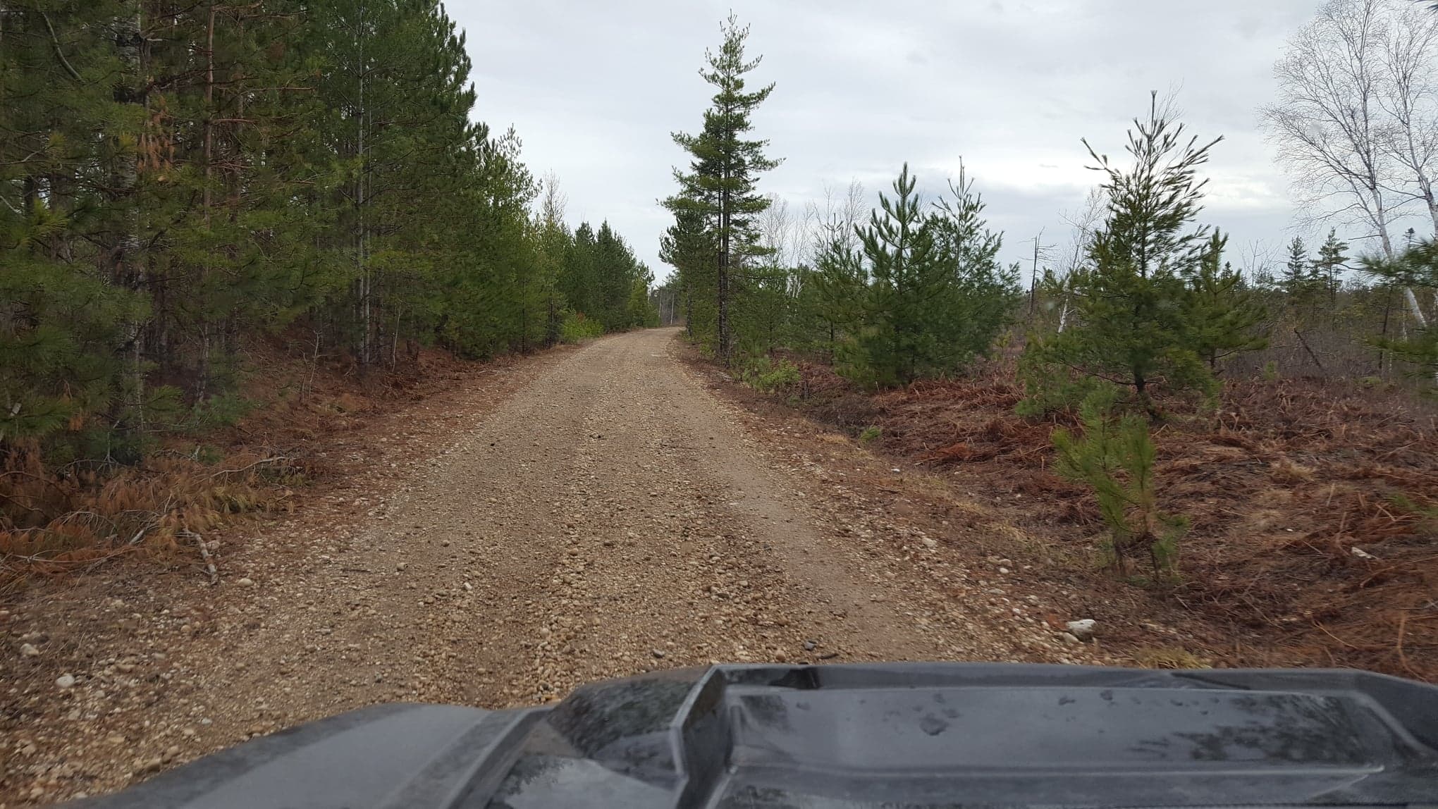
Very Good overall conditions
Dusty Surface
1 general warning
3 trail warnings
Great Riding Conditions!
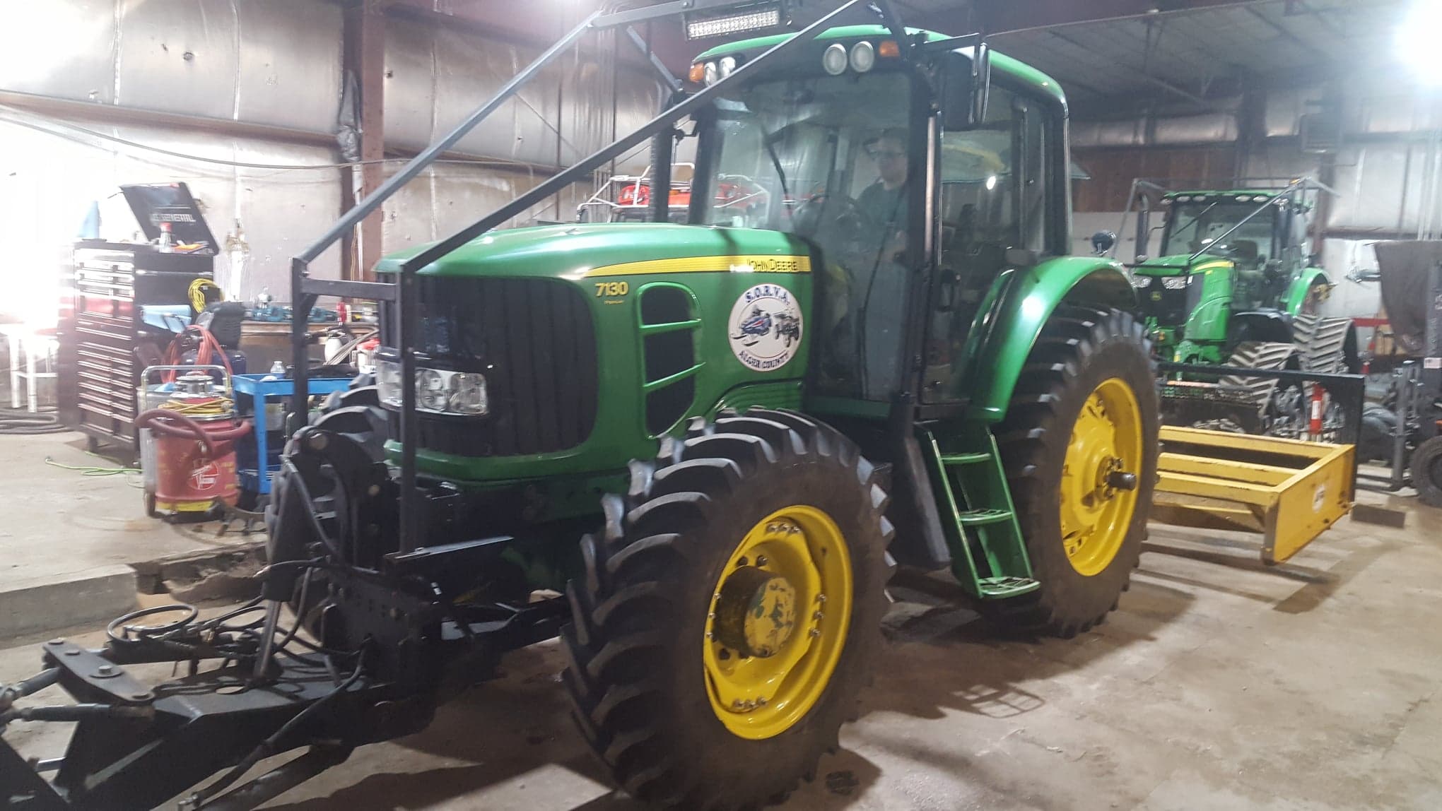
Trails have dried up in most areas with great off road conditions. Overall trails are great with some of the softer sand areas just starting to get the washboard conditions. Today the front tracks were replaced with tires on the John Deere 7130 along with the box grader hooked up and ready to go. Stay tuned for updates as grading operations get started. Ride Safe and Enjoy the outdoors!
Grading Operations: Starting soon
Photo: Route “C” and 7130 Ready for grading
Be sure to patronize and thank your Trail Sponsors!
Today’s Trail Report brought to you by: North Star Hotel – Munising/Wetmore, MI
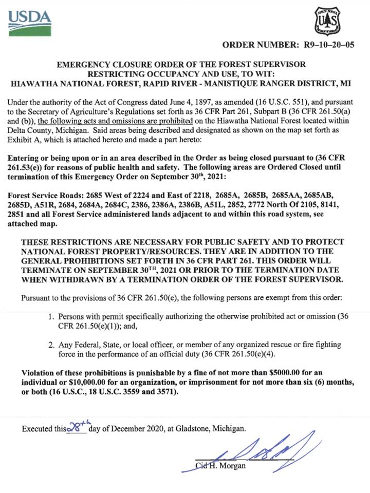
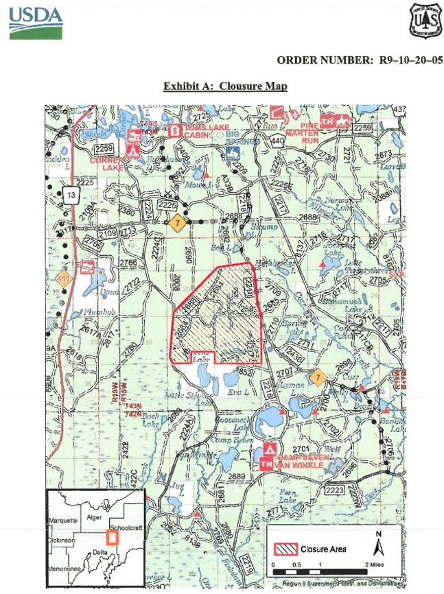
- KNOW WHERE YOU RIDE in the Stevens Lake F-16 crash site area. This is located near Snowmobile Trails 7 to the North and East and Trail 411 to the West. Order in effect through September 30, 2021. Notice from the National Forest: "Just a heads up to remind riders to stay on trails especially around or near the crash site they can be fined or imprisoned if caught inside perimeter thanks" Please review Order and Map in images below so you avoid this area.
Smooth and Dry
(Route "C") Primarily decent off road conditions with some washboard starting in the soft sandy areas.
Smooth and Dry
(Partial Route "C") Primarily smooth gravel riding, Some washboard near M-94 and wet muddy areas just west of M-94
Smooth and Dry
Primarily smooth gravel, some washboard just north of Doe Lake Road and wet muddy areas closer to CR440.
Smooth and Dry
(Partial Route "C") Primarily dry smooth gravel with wash boarded soft sand for a few miles between Trail "C" and Christmas. Typical off road riding in the hills.
Smooth and Dry
Closed between Munising and Wetmore. Pretty much a split between wet and muddy sections and soft sand areas. Heading to Munising take Connors Road North to H-58 West.
Smooth and Dry
Primarily soft sand areas and very rocky areas with some wet and muddy sections.
CLOSED TO WHEELED VEHICLES for 2 miles heading West from Brook Street in Munising. Follow Detour signs North along Brook Street to Varnum Street West to the end and up St Martins Hill. Then left on Gage Road for .4 miles and turn left on trail at corner and follow .6 miles to Trail 419. (Reverse coming from Christmas)
Smooth and Dry
(Route "C") Decent gravel riding with some soft wash boarded sand near the Au Train River
Ride with caution on AuTrain River Bridge as there is damaged railing.
Smooth and Dry
(Route "C") Primarily hard gravel with some wet areas, soft sand and washboard closer to Chocolay Twp. and Kawbawgam Rd.
Wet and Muddy
Primarily dry with some wet and muddy areas between M-28 and H-58.
Moguls
Primarily moguled sand with a wet and muddy section near the middle.
Wet and Muddy
Primarily wet and muddy with sandy moguls about 5 miles North of Shinlgleton.
Gates are closed just north of Shingleton so ORV’s must take H-15 North of M-28 for .75 miles and head East to access Trail 8 North. Deep water along M-94 just south of Shingleton.
Copyright © 2021 – SORVA of Alger County